
The Amazing Carolina Bays
- nicholaslprince
- Feb 12, 2023
- 5 min read
Updated: Feb 13, 2023
Prince Bay Farm encompasses Prince Bay and Little Grassy Bay, two of the myriad of Carolina Bays that dot the Eastern seaboard of the US.
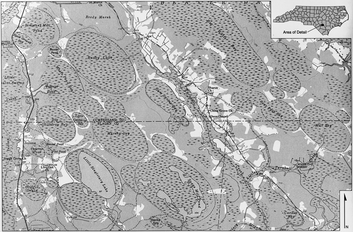
Carolina bays are elliptical depressions concentrated along the Atlantic seaboard within coastal Delaware, Maryland, New Jersey, North Carolina, South Carolina, Virginia, Georgia, and north central Florida.
The Carolina Bays are a group of lakes, wetlands, and depressions, stretching from Florida to New Jersey along the Atlantic Ocean, and ranging up to 11 km in length and about 15 m in depth. Their distinctive elliptical shapes and common orientation towards the Great Lakes region have generated many hypotheses about their method of formation, including extraterrestrial impact (Melton and Schriever, 1933; Prouty, 1934).
Carolina bays vary in size from one to several thousand acres. About 500,000 of them are present in the classic area of the Atlantic Coastal Plain, often in groups, with each bay invariably aligned in a northwest-southeast direction.
The bays have many different vegetative structures, based on the depression depth, size, hydrology, and subsurface.
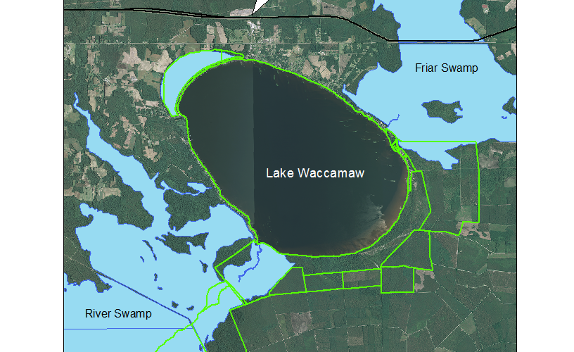
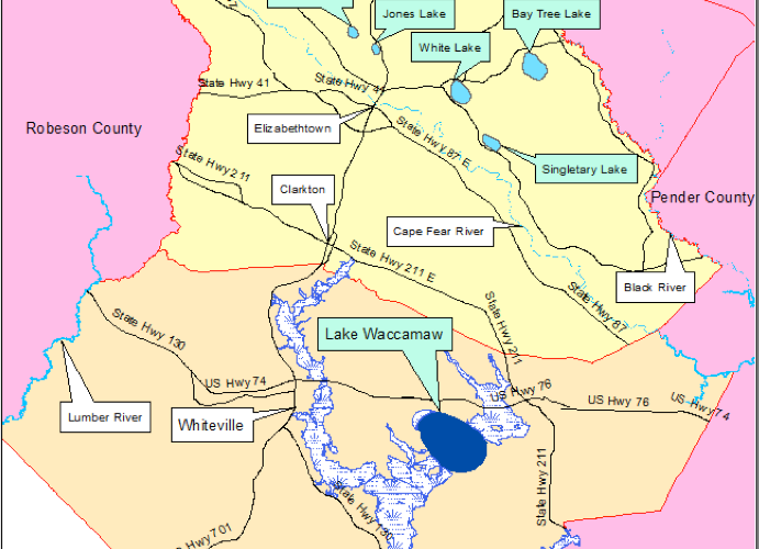
Many are marshy; a few of the larger ones are (or were before drainage) lakes; 36 square km (14 square mile) Lake Waccamaw is an undrained one.
Some bays are predominantly open water with large scattered pond cypress, while others are composed of thick, shrubby areas (pocosins), with vegetation growing on floating peat mats.
Generally the southeastern end has a higher rim composed of white sand.
They are named for the bay trees frequently found in them, not because of the frequent ponding of water (Sharitz 2003).

The bays are especially rich in biodiversity, including some rare and/or endangered species.
Species that thrive in the bays' habitats include birds, such as turkeys, wood storks, herons, egrets, and other migratory waterfowl, mammals such as deer, black bears, coyotes, foxes, raccoons, skunks, and opossums.


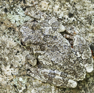
Other residents include dragonflies, green anoles and green tree frogs.


The bays contain trees such as black gum, bald cypress, pond cypress, sweet bay, loblolly bay, red bay, sweet gum, maple, magnolia, pond pine, and shrubs such as fetterbush, clethra, sumac, button bush, zenobia, and gallberry.

Plants common in Carolina bays are water lilies, sedges and various grasses.
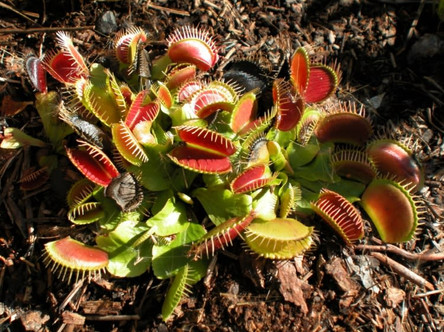
Several carnivorous plants inhabit Carolina bays, including the Venus flytrap, bladderwort, butterwort, pitcher plant, and sundew. https://bdj.pensoft.net/article/7964/
https://www.nature.org/en-us/about-us/where-we-work/united-states/north-carolina/stories-in-north-carolina/pitcher-venus-flytrap-carnivorous-plants/


Hypothesis: Carolina bays are remnants of a cosmic collision. Cintos researcher Michael Davias used LiDAR digital elevation maps and Google Earth to study the circumferal rims and orientation of the shallow basins of the Atlantic coastal plain. Davias’s research model is that the Carolina bays resulted from the impact of debris from an oblique cosmic collision with the Wisconsin ice sheet. (Davias, 2012) Davias believes that a large low density comet composed of hydrated silica impacted the ice sheet overlaying current day Michigan, specifically the Saginaw region and Lake Huron, see figure 3. The comet is thought to have hit on a nearly tangential angle, creating a non-typical oval crater orientated southwest to northeast, coined by Davias as the Saginaw impact structure. It is deeper toward the Northeast (Lake Huron) and characterized by an arced central ridge called Charity islands that is thought to be rebounded strata. These features (the ridge, the upward deeper excavation and oval shape) of the Saginaw crater are expected attributes of an oblique impact structure. Furthermore, he argues that the ice sheet itself protected the sedimentary strata of the Michigan basin, thus shearing the land rather than compressing it, therefore shocked quartz and other classic impact markers are not present. The impact ejected superheated ice and sediments outward in a butterfly pattern away from the site. See Figures 3 & 4. Davias argues that Carolina bays are evidence of a blanket of distal ejecta from this collision. Specifically he proposes “that shallow basins were created during the energetic deflation of gas inclusions in those superheated hydrous ejecta. The resulting paleobasins have persisted over the intervening millennia as “Carolina bays”, “Rainwater Basins”, “Maryland Basins”, etc, while being overlain with loess and subjected to reworking by water and wind erosion.” Taking into account the Coriolis effect during flight time of the ejecta and the curvature of earth, he seeks to interpolate the original impact site using bay orientation data collected from LiDAR imagery overlaying in google earth. (Davias, 2010) Figure 3: Michael Davias’s proposed location of the Saginaw Impact Stucture. Here a comet is thought to have hit the Wisonsian Ice Sheet on a nearly tangential angle. The crater is deeper toward the Northeast and characterized by an arced central ridge called Charity islands that is thought to be rebounded strata. The ice sheet itself protected the sedimentary strata of the Michigan basin, thus shearing the land rather than compressing it, therefore shocked quartz and other classic impact markers are not present. Figure 4: Researcher Michael Davias proposes that bay formations are the remnants of an ancient cosmic collision with the Wisconsian ice sheet. He hypothesizes that the impact ejected superheated ice and sediments outward in a butterfly pattern creating the shallow basins commonly know as Carolina bay formations. https://pbisotopes.ess.sunysb.edu/lig/Conferences/abstracts13/Gill.pdf

In the research work, "Formation of the Carolina Bays: ET Impact vs. Wind-and-Water" from January 2007, by authors Robert E. Kobres, George Howard, Richard Firestone, et al. found the following:
Results from a suite of cores taken from within a Bay, which we have named "Howard Bay," located about 2 km north of the town of Duart in Bladen County, North Carolina. Located on the high western bluff of the Cape Fear River, the Bay is 2.7 km long, 1.6 km wide, and filled with about 9 meters of sediment with an encircling rim that is ~1-meter high. Analyses of seven cores along the long axis of Howard Bay reveal an assemblage of abundant magnetic grains, microspherules, carbon spherules, glass-like carbon, and iridium, typical of the YDB impact layer (12.9 ka) at many other sites across North America.


The impact layer conforms to the basal contours of the basin, suggesting that the markers were deposited immediately or soon after the Bay formed. Further analyses of samples in complete core sequences reveal that, unlike typical, peat-rich Carolina Bays, Howard Bay essentially lacks peat, diatoms, pollen, or other organic materials, suggesting that this Bay never stored water for any sustained length of time. Furthermore, several trenches confirm that the deepest part of the Bay is filled with >6 m of cross-bedded eolian sand with no evidence of lacustrine sedimentation. This evidence calls into question prevailing hypotheses (a) that all Bays were lakes and ponds in the past and that their shapes were formed by wave action, or (b) that groundwater movement led to subsidence that formed the Bay. The presence of impact markers, including high concentrations of iridium, in a layer just above the basal sediments of this Bay that is filled with eolian sand supports the extraterrestrial impact hypothesis for Bay formation.


Comments